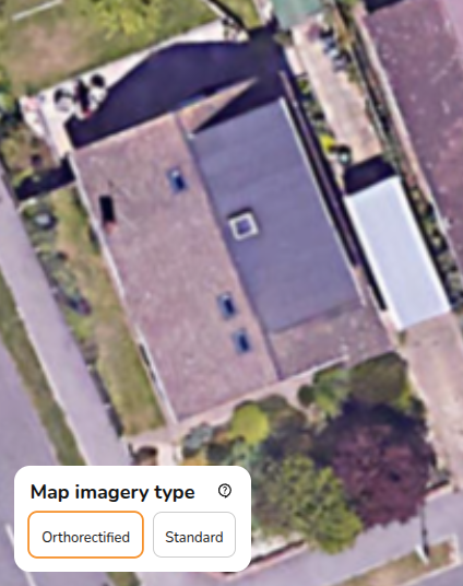
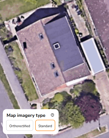
What is the difference between orthorectified and standard satellite imagery?
The orthorectified map is geometrically corrected to give more accurate dimensions. The standard map uses raw satellite data which means dimensions may be distorted, particularly for sloped structures.
Where possible you will want to use the orthorectified map, if it is not available then the dimensions in Easy PV may not be accurate to the actual dimensions.